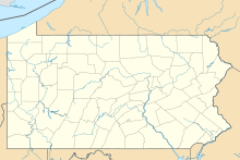
Warriors Path State Park
State park in Bedford County, PennsylvaniaWarriors Path State Park is a Pennsylvania state park on 349 acres (141 ha) in Liberty Township, Bedford County, Pennsylvania, in the United States. It is named for the Great Indian Warpath that was used by the Iroquois in war raids with the Cherokee and other tribes. Warriors Path State Park is surrounded on three sides by the Raystown Branch Juniata River. The park is a seasonal day use park. The park can be accessed by foot from the main gate when the gate is closed November through mid-April.
Read article
Top Questions
AI generatedMore questions
Nearby Places

Coaldale, Bedford County, Pennsylvania
Borough in Pennsylvania, United States

Saxton, Pennsylvania
Borough in Pennsylvania, United States

Coalmont, Pennsylvania
Borough in Pennsylvania, United States

Defiance, Pennsylvania
Census-designated place in Pennsylvania, United States

Saxton Nuclear Generating Station
Decommissioned nuclear power plant in Pennsylvania

Riddlesburg, Pennsylvania
Census-designated place in Pennsylvania, United States
Tussey Mountain Junior/Senior High School
School in Saxton, Pennsylvania, United States

Stonerstown, Pennsylvania
Census-designated place in Pennsylvania, United States


